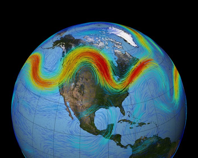
❄️ What’s Going On: The Triple-Dip Polar Vortex
Meteorologists forecast that a disrupted polar vortex will send three successive blasts of Arctic air across large parts of the United States during December.
Under normal circumstances, the polar vortex a massive, spinning pool of cold air anchored near the North Pole keeps frigid air locked up in the Arctic. But a recent event of sudden stratospheric warming has disturbed that stability, allowing cold air to plunge southward instead.
As a result, the U.S. is bracing for a series of Arctic blasts rather than a single cold snap hence the “triple-dip” warning.
️ Which Regions and States Are Expected to Be Affected
Upper Midwest & Great Plains
States like Minnesota, North Dakota, South Dakota, Nebraska, Iowa and others in the High Plains are forecast to see subzero temperatures, bitter wind chills, and possible snow squalls.
Midwest & Great Lakes Region
States across the Midwest, including Wisconsin, Michigan, and areas around the Great Lakes already accustomed to winters should prepare for one of the coldest stretches yet this season, with single-digit lows expected.
Ohio Valley, Interior Northeast & Mid-Atlantic
As Arctic air moves eastward, the Ohio Valley, Appalachians, and Northeast corridor including states like Pennsylvania, New York, New Jersey, and parts of the Mid-Atlantic could experience sub-freezing conditions, frost, and snow squalls.
Southeast and Borderline Southern States
Some parts of the South even states that rarely see winter cold may feel an icy jolt, especially inland areas. The polar vortex is expected to stretch far enough south to bring below-average temperatures and risk of hard freezes.
Even regions like the Southeast (previously unaccustomed to such cold) are urged to prepare winterizing homes, securing heating fuel, and checking water lines before temperatures drop.
⚠️ What to Watch Out For: Impacts for People
-
Freezing temperatures & frost risk — surfaces like roads, sidewalks and unprotected pipes may freeze quickly.
-
Dangerous wind-chill — actual temperature might feel 10–25 °F colder than the thermometer reading.
-
Snow squalls and blizzard-like conditions — patches of heavy snow, especially near Great Lakes, Appalachians, and the Northeast corridor; travel hazards expected.
-
Increased energy demand & possible strain on infrastructure — as heaters and furnaces work overtime, demand on electricity, gas, and heating fuel may spike.
-
Need for emergency preparedness — people should check heating systems, insulate pipes, stock up on essentials (food, medicine, warm clothing), and avoid unnecessary travel.
Why This Polar Vortex Is Unusual And What It Means
This “triple-dip” event stands out because it stems from a stratospheric warming event that disrupted the usual polar vortex structure a rare phenomenon especially for early winter.
Such disruptions weaken the barrier that normally traps Arctic air, enabling multiple surges of frigid air to flow southward over weeks. That means cold waves could return several times before warming trends resume an extended winter ordeal, not a one-off event.
Climate factors like La Niña may also influence how widespread and intense the cold air incursions get, potentially exacerbating winter conditions.
✅ What You Should Do Now
-
Confirm your heating system works; service if needed.
-
Insulate exposed pipes and winterize home plumbing.
-
Have emergency supplies: non-perishables, medications, warm clothing, battery backups.
-
Avoid travel during snow squalls or freeze warnings if possible.
-
Stay updated via local weather advisories — cold snaps may strike suddenly.


